
OAKVILLE, ON – While we should still keep our winter coats handy, most Canadians can expect near normal to above-average temperatures on the way this spring, according to meteorologists’ predictions at The Weather Network.
British Columbia will be the exception, however, as much of the province will experience a slower start to spring, with below normal temperatures expected.
While temperatures are predicted to be above normal across parts of the country, Canadians east of the Rocky Mountains should not expect the record-setting warmth experienced last spring.
Weather forecasts for the next two weeks are typical for the start of spring, with dramatic swings in temperature expected. After a chilly first weekend of March for much of the country, a tease of warmer weather will spread across many regions this upcoming weekend only to be followed by a return to cold air next week.
“Canadians typically find themselves riding a rollercoaster of weather conditions at the start of spring which means there's still the potential for wintry surprises in March across most parts of the country,” said Chris Scott, Director of Meteorology for The Weather Network. “It's unlikely we’ll experience the all-time record high temperatures of last March, but Canadians can always count on extra daylight hours and the increased intensity of the sun that comes with the arrival of spring.”

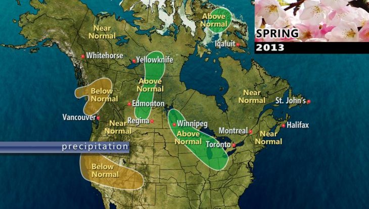
Precipitation forecasts for most of the country (see image at right) will be at around normal to above-normal levels, with the exception of central interior B.C.